Land Surface Temperature with Directional Effects - MSG
Abstract:
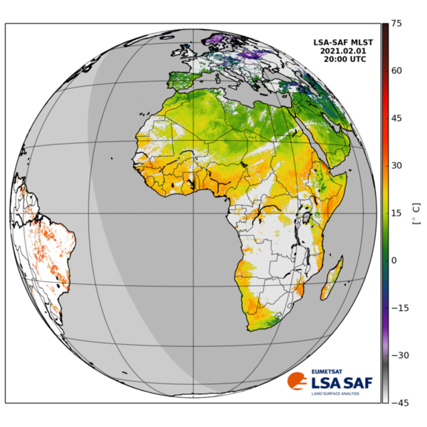
Land Surface Temperature (LST) is the radiative skin temperature over land. LST plays an important role in the physics of land surface as it is involved in the processes of energy and water exchange with the atmosphere. LST is useful for the scientific community, namely for those dealing with meteorological and climate models. Accurate values of LST are also of special interest in a wide range of areas related to land surface processes, including meteorology, hydrology, agrometeorology, climatology and environmental studies. Land Surface Emissivity (EM), a crucial parameter for LST retrieval from space, is independently estimated as a function of (satellite derived) Fraction of Vegetation Cover (FVC) and land cover classification.
In the most recent version of the dataset, information on the expected deviation of LST estimates from SEVIRI/MSG with respect to a reference view – here considered to be nadir view – has been added to the original product (LSA-001) as an extra data layer (LSA-004).
Download plain xml file
To get the data: go to WIS-Portal
Metadata Information
General
| Attribute | Value |
|---|---|
| fileIdentifier/identifier | urn:x-wmo:md:int.eumetsat:EO:EUM:DAT:0394 |
| language | eng |
| characterSet | utf8 |
| hierarchyLevel | series |
| hierarchyLevelName |
|
| contact | see section contact (role: pointOfContact) |
| dateStamp | 2021-10-14 |
| metadataStandardName | WMO Core Metadata Profile of ISO 19115 (WMO Core), 2003/Cor.1:2006 (ISO 19115), 2007 (ISO/TS 19139) |
| metadataStandardVersion | 1.3 |
| referenceSystemInfo | |
| metadataExtensionInfo |
identificationInfo
| Attribute | Value |
|---|---|
| citation | |
| abstract | see above |
| status | onGoing |
| purpose | |
| pointOfContact | see section contact (role: originator) |
| graphicOverview | https://navigator.eumetsat.int/preview/LSASAF_MSG_LST_MSG-Disk.png |
| resourceMaintenance |
|
| descriptiveKeywords: |
|
| resourceConstraints |
|
| language | eng |
| characterSet | utf8 |
| topicCategory | climatologyMeteorologyAtmosphere |
| extent | boundingExtent
|
Contact
Role: pointOfContact
| Attribute | Value |
|---|---|
| individualName | EUMETSAT SAF on Land Surface Analysis |
| organisationName | LSA SAF |
| contactInfo |
|
Role: distributor
| Attribute | Value |
|---|---|
| individualName | |
| organisationName | LSA SAF & EUMETSAT |
| positionName | |
| contactInfo |
Role: originator
| Attribute | Value |
|---|---|
| organisationName | LSA SAF |
| contactInfo |
|
contentInfo
| Attribute | Value |
|---|---|
| CoverageDescription: |
|
distributionInfo
| Attribute | Value |
|---|---|
| distributionFormat |
|
| transferOptions (onLine) |
|
dataQualityInfo
| Attribute | Value |
|---|---|
| scope | series |
| report |
|
| lineage |
|