Geophysical Data Record - Sea Surface Height Anomaly - Jason-2
Abstract:
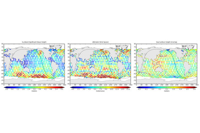
The Geophysical Data Record - Sea Surface Height Anomaly (GDR-SSHA) is available to users within 60 days from instrument sensing. The main geophysical parameters in the GDR-SSHA product is sea surface height anomaly, derived from the Poseidon altimeter on-board the Jason2 satellite. This is product is given at 1 Hz sampling, and includes all the parameters used into the calculation of the sea surface height anomaly, such as altimeter ranges, orbit data (altitude), water vapour correction, geophysical corrections and geophysical references. Other important parameters, intended to help with the interpretation and use of the data for different applications, are also included. These are for example backscatter coefficients and a range of processing quality flags. This is a fully validated, high accuracy product. A precise orbit is used, estimated from DORIS, Laser Ranging and GPS measurements. Each file contains data corresponding to a pole to pole pass. This product is mainly targeting climate and science applications.
Download plain xml file
To get the data: go to WIS-Portal
Metadata Information
General
| Attribute | Value |
|---|---|
| fileIdentifier/identifier | urn:x-wmo:md:int.eumetsat:EO:EUM:DAT:JASON:GDR-SSHA |
| language | eng |
| characterSet | utf8 |
| hierarchyLevel | series |
| hierarchyLevelName |
|
| contact | see section contact (role: pointOfContact) |
| dateStamp | 2024-01-18 |
| metadataStandardName | WMO Core Metadata Profile of ISO 19115 (WMO Core), 2003/Cor.1:2006 (ISO 19115), 2007 (ISO/TS 19139) |
| metadataStandardVersion | 1.3 |
| referenceSystemInfo | |
| metadataExtensionInfo |
identificationInfo
| Attribute | Value |
|---|---|
| citation | |
| abstract | see above |
| status | |
| purpose | |
| pointOfContact | see section contact (role: originator) |
| graphicOverview | https://navigator.eumetsat.int/preview/jason-2.jpg |
| resourceMaintenance |
|
| descriptiveKeywords: |
|
| resourceConstraints |
|
| language | eng |
| characterSet | utf8 |
| topicCategory | climatologyMeteorologyAtmosphere |
| extent | boundingExtent
|
Contact
Role: pointOfContact
| Attribute | Value |
|---|---|
| individualName | Centre National d'Etudes Spatiales |
| organisationName | CNES |
| contactInfo |
|
Role: distributor
| Attribute | Value |
|---|---|
| individualName | Centre National d'Etudes Spatiales |
| organisationName | CNES |
| positionName | |
| contactInfo |
|
Role: originator
| Attribute | Value |
|---|---|
| organisationName | CNES |
| contactInfo |
|
contentInfo
| Attribute | Value |
|---|---|
| CoverageDescription: |
|
distributionInfo
| Attribute | Value |
|---|---|
| distributionFormat |
|
| transferOptions (onLine) |
|
dataQualityInfo
| Attribute | Value |
|---|---|
| scope | series |
| report |
|
| lineage |
|