Operational Geophysical Data Record - Sea Surface Height Anomaly - Jason-3
Abstract:
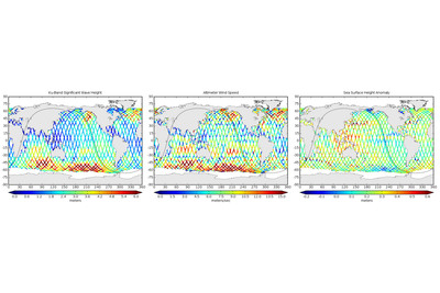
The Operational Geophysical Data Record - Sea Surface Height Anomaly (OGDR-SSHA) is a near real-time operational product delivered to users within 3 - 5 hours from instrument sensing. It can be considered a subset, or derived data set from the complete OGDR product. The main geophysical parameter in the OGDR-SSHA product is sea surface height anomaly, derived from the Poseidon altimeter on-board the Jason-3 satellite. This product is given at I Hz sampling, and includes all the parameters used in the calculation of sea surface height anomalies, such as altimeter ranges, orbit data (altitude), water vapour correction, geophysical corrections and geophysical references. Other important parameters, intended to help with the interpretation and use of the data for different applications, are also included in the product. These include backscatter coefficients and a range of processing quality flags. This product is mainly targeted at operational weather and ocean forecasting applications. This data set is jointly generated by NOAA and EUMETSAT. Jason-3 is a contributing mission of the EU Copernicus Programme.
Download plain xml file
To get the data: go to WIS-Portal
Metadata Information
General
| Attribute | Value |
|---|---|
| fileIdentifier/identifier | urn:x-wmo:md:int.eumetsat:EO:EUM:DAT:JASON:JA3-OGDR-SSHA |
| language | eng |
| characterSet | utf8 |
| hierarchyLevel | series |
| hierarchyLevelName |
|
| contact | see section contact (role: pointOfContact) |
| dateStamp | 2024-01-18 |
| metadataStandardName | WMO Core Metadata Profile of ISO 19115 (WMO Core), 2003/Cor.1:2006 (ISO 19115), 2007 (ISO/TS 19139) |
| metadataStandardVersion | 1.3 |
| referenceSystemInfo | |
| metadataExtensionInfo |
identificationInfo
| Attribute | Value |
|---|---|
| citation | |
| abstract | see above |
| status | onGoing |
| purpose | |
| pointOfContact | see section contact (role: originator) |
| graphicOverview | https://navigator.eumetsat.int/preview/jason-2.jpg |
| resourceMaintenance |
|
| descriptiveKeywords: |
|
| resourceConstraints |
|
| language | eng |
| characterSet | utf8 |
| topicCategory | climatologyMeteorologyAtmosphere |
| extent | boundingExtent
|
Contact
Role: pointOfContact
| Attribute | Value |
|---|---|
| individualName | European Organisation for the Exploitation of Meteorological Satellites |
| organisationName | EUMETSAT |
| contactInfo |
|
Role: distributor
| Attribute | Value |
|---|---|
| individualName | European Organisation for the Exploitation of Meteorological Satellites |
| organisationName | EUMETSAT |
| positionName | |
| contactInfo |
|
Role: originator
| Attribute | Value |
|---|---|
| organisationName | EUMETSAT |
| contactInfo |
|
contentInfo
| Attribute | Value |
|---|---|
| CoverageDescription: |
|
distributionInfo
| Attribute | Value |
|---|---|
| distributionFormat |
|
| transferOptions (onLine) |
|
dataQualityInfo
| Attribute | Value |
|---|---|
| scope | series |
| report |
|
| lineage |
|