ASCAT Winds at 12.5 km Swath Grid - Metop
Abstract:
The ASCAT Wind Product contains measurements of the wind direction and wind speed at 10 m above the sea surface. The measurements are obtained through the processing of scatterometer data originating from the ASCAT instrument on EUMETSAT's Metop satellite, as described in the ASCAT Wind Product User Manual. Note that up until 2011-02-28, a wind-only version of this product in BUFR and netCDF formats was available via EUMETCast and the EUMETSAT Data Centre. From that date on, the wind values can be found in BUFR and netCDF formats in the ASCAT multi-parameter products (collection reference: EO:EUM:DAT:METOP:OAS012 and EO:EUM:DAT:METOP:OAS025). It is recommended that the reprocessed ASCAT winds data records (EO:EUM:DAT:METOP:OSI-150-B, EO:EUM:DAT:METOP:OSI-150-A) are used instead of this archived NRT product.
Download plain xml file
To get the data: go to WIS-Portal
Metadata Information
General
| Attribute | Value |
|---|---|
| fileIdentifier/identifier | urn:x-wmo:md:int.eumetsat:EO:EUM:DAT:METOP:ASCAT12 |
| language | eng |
| characterSet | utf8 |
| hierarchyLevel | series |
| hierarchyLevelName |
|
| contact | see section contact (role: pointOfContact) |
| dateStamp | 2024-01-18 |
| metadataStandardName | WMO Core Metadata Profile of ISO 19115 (WMO Core), 2003/Cor.1:2006 (ISO 19115), 2007 (ISO/TS 19139) |
| metadataStandardVersion | 1.3 |
| referenceSystemInfo | |
| metadataExtensionInfo |
identificationInfo
| Attribute | Value |
|---|---|
| citation | |
| abstract | see above |
| status | Superseded |
| purpose | |
| pointOfContact | see section contact (role: originator) |
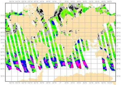
| graphicOverview | https://navigator.eumetsat.int/preview/osi_ascat12.5.jpg |
| resourceMaintenance |
|
| descriptiveKeywords: |
|
| resourceConstraints |
|
| language | eng |
| characterSet | utf8 |
| topicCategory | climatologyMeteorologyAtmosphere |
| extent | boundingExtent
|
Contact
Role: pointOfContact
| Attribute | Value |
|---|---|
| individualName | EUMETSAT SAF on Ocean and Sea Ice |
| organisationName | OSI SAF |
| contactInfo |
|
Role: distributor
| Attribute | Value |
|---|---|
| individualName | European Organisation for the Exploitation of Meteorological Satellites |
| organisationName | EUMETSAT |
| positionName | |
| contactInfo |
|
Role: originator
| Attribute | Value |
|---|---|
| organisationName | OSI SAF |
| contactInfo |
|
contentInfo
| Attribute | Value |
|---|---|
| CoverageDescription: |
|
distributionInfo
| Attribute | Value |
|---|---|
| distributionFormat |
|
| transferOptions (onLine) |
|
dataQualityInfo
| Attribute | Value |
|---|---|
| scope | series |
| report |
|
| lineage |
|