Merged Atlantic Product Surface Solar Irradiance - Multimission
Abstract:
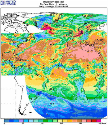
Estimation of the solar irradiance reaching the Earth surface , derived from the geostationary satellites data (GOES and MSG). The daily Merged Atlantic Product SSI values are mean values over the considered period of time, 24 hours. SSI values are expressed in tenths of W/m2. This product was superseded in 2011 by the Meteosat Surface Solar Irradiance (OSI-304 series) and the GOES-East Surface Solar Irradiance (OSI-306 series).
Download plain xml file
To get the data: go to WIS-Portal
Metadata Information
General
| Attribute | Value |
|---|---|
| fileIdentifier/identifier | urn:x-wmo:md:int.eumetsat:EO:EUM:DAT:MULT:MAPSSI |
| language | eng |
| characterSet | utf8 |
| hierarchyLevel | series |
| hierarchyLevelName |
|
| contact | see section contact (role: pointOfContact) |
| dateStamp | 2020-11-17 |
| metadataStandardName | WMO Core Metadata Profile of ISO 19115 (WMO Core), 2003/Cor.1:2006 (ISO 19115), 2007 (ISO/TS 19139) |
| metadataStandardVersion | 1.3 |
| referenceSystemInfo | |
| metadataExtensionInfo |
identificationInfo
| Attribute | Value |
|---|---|
| citation | |
| abstract | see above |
| status | Superseded |
| purpose | |
| pointOfContact | see section contact (role: originator) |
| graphicOverview | https://navigator.eumetsat.int/preview/osi_map_ssi.jpg |
| resourceMaintenance |
|
| descriptiveKeywords: |
|
| resourceConstraints |
|
| language | eng |
| characterSet | utf8 |
| topicCategory | climatologyMeteorologyAtmosphere |
| extent | boundingExtent
|
Contact
Role: pointOfContact
| Attribute | Value |
|---|---|
| individualName | EUMETSAT SAF on Ocean and Sea Ice |
| organisationName | OSI SAF |
| contactInfo |
|
Role: distributor
| Attribute | Value |
|---|---|
| individualName | European Organisation for the Exploitation of Meteorological Satellites |
| organisationName | EUMETSAT |
| positionName | |
| contactInfo |
|
Role: originator
| Attribute | Value |
|---|---|
| organisationName | OSI SAF |
| contactInfo |
|
contentInfo
| Attribute | Value |
|---|---|
| CoverageDescription: |
|
distributionInfo
| Attribute | Value |
|---|---|
| distributionFormat |
|
| transferOptions (onLine) |
|
dataQualityInfo
| Attribute | Value |
|---|---|
| scope | series |
| report |
|
| lineage |
|