Fraction of Absorbed Photosynthetically Active Radiation V2 - PROBA-V - South America
Abstract:
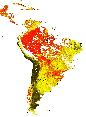
FAPAR quantifies the fraction of the solar radiation absorbed by plants for photosynthesis. It refers only to the green and living elements of the canopy. FAPAR is useful as input to a number of primary productivity models and is recognized as an Essential Climate Variable (ECV) by the Global Climate Observing System (GCOS). The FAPAR 1km version 2 product is derived by first calculating instantaneous estimates using a neural network and calibrated daily Top of the Canopy reflectances as input. In a second step these instantaneous estimates are composited using an asymmetric period and performing a temporal smooth and gap fill operation based on the land cover type (Evergreen Broadleaf Forest or not).
Download plain xml file
To get the data: go to WIS-Portal
Metadata Information
General
| Attribute | Value |
|---|---|
| fileIdentifier/identifier | urn:x-wmo:md:int.eumetsat:EO:EUM:DAT:PROBA-V:FAPARSA-V2 |
| language | eng |
| characterSet | utf8 |
| hierarchyLevel | series |
| hierarchyLevelName |
|
| contact | see section contact (role: pointOfContact) |
| dateStamp | 2021-11-09 |
| metadataStandardName | WMO Core Metadata Profile of ISO 19115 (WMO Core), 2003/Cor.1:2006 (ISO 19115), 2007 (ISO/TS 19139) |
| metadataStandardVersion | 1.3 |
| referenceSystemInfo | |
| metadataExtensionInfo |
identificationInfo
| Attribute | Value |
|---|---|
| citation | |
| abstract | see above |
| status | |
| purpose | |
| pointOfContact | see section contact (role: originator) |
| graphicOverview | https://navigator.eumetsat.int/preview/FAPAR.png |
| resourceMaintenance |
|
| descriptiveKeywords: |
|
| resourceConstraints |
|
| language | eng |
| characterSet | utf8 |
| topicCategory | climatologyMeteorologyAtmosphere |
| extent | boundingExtent
|
Contact
Role: pointOfContact
| Attribute | Value |
|---|---|
| individualName | EC Copernicus Global Land Service, operated by VITO |
| organisationName | VITO |
| contactInfo |
|
Role: distributor
| Attribute | Value |
|---|---|
| individualName | |
| organisationName | VITO & EUMETSAT |
| positionName | |
| contactInfo |
Role: originator
| Attribute | Value |
|---|---|
| organisationName | VITO |
| contactInfo |
|
contentInfo
| Attribute | Value |
|---|---|
| CoverageDescription: |
|
distributionInfo
| Attribute | Value |
|---|---|
| distributionFormat |
|
| transferOptions (onLine) |
|
dataQualityInfo
| Attribute | Value |
|---|---|
| scope | series |
| report |
|
| lineage |
|